Saturday, January 12, 2013

Looking Ahead

The Where and When of the CDT

When Sara and I decided to hike the Continental Divide Trail we knew it was going to take a lot of planning, but we assumed we would just pick any of a number of guide books, find some maps and plot the route along the trail.  Of course we were counting on a few hangups, but not that there are really only two major guidebooks, which both detail different routes and one is not too helpful if you are hiking north.  Nor were we aware that the route is not even on most maps and the "official" CDT map is compiled by Jonathon Ley in his spare time and that one of the guide books does not follow Ley's route, rendering that book nearly useless.  The factor that has/will present/ed the most difficulty, and what truly sets it apart from the Appalachain Trail and the Pacific Crest Trail, is the trail is only about 70% completed and therefore subject to the map reader's whims.
Sara enjoying the lack of trail in the Grand Canyon.

 In all of our research we keep finding the mantra, "hike your own hike."  Meaning, since there is not an official trail that 100% of people agree on, find what works for you.  Hike the speed that works for you.  Carry what works for you.  Resupply where works for you.  Eat however much ice cream works for you.  This is great for us because we want an adventure that does not have pressure to see certain things or stop at certain places.  At the same time this also left us with very little to go off of in terms of planning. 
Map from Jonathon Ley through CO.  Red is suggested route, purple is alternate


My brother is planning a trip on the PCT and he showed me a bandana that is a map of the trail with all the resupply points along the route.  With no bandana map for the CDT, Sara and I were prepared to painstakingly flip through atlas pages to find all the small towns and lodges along the way that might have a mail box.  Fortunately for us, the set of maps that Jonathon Ley has put together is absolutely amazing complete with comments and alternate routes drawn in.  Additionally, the Yogi Guide Book provides the Ley map number for each resupply point and subject the book mentions, which means we just had to do some math to decide how many miles we want to go between each resupply.
Section of Wind Rivers
At first we wanted to go 7-10 days between resupplies.  Then we spent four days in the Grand Canyon and maxed out the volume in our packs.  Granted it was over Thanksgiving so we were carrying a pie, wine, and food that we normally would not carry, but we still would not have much room to comfortably carry ten days worth of rations.  Now our longest stretch will be eight days and our shortest three or four.  This way our packs will not be as heavy when we leave resupply points and we have room for gear and a pint of ice cream.
Thanksgiving stuffing in the bottom of the Grand Canyon

Mileage was another thing to consider for us.  When my parents did the PCT in the 1980's, they averaged between 13 and 15 miles a day.  Originally we figured we could average close to 18 because we have the advantage of lighter gear and having maintained some level of fitness after competing in collegiate athletics.  After reading blogs and speaking with previous hikers, however, we realized we could up our projected average.  Most people average just over 20 miles a day.  Apparently lighter gear makes a big difference.  This also made our math much easier.  100 miles equals five days.   

Aside from, "hike your own hike," the other big thing we have been told is to be flexible.  On start date, on routes, on zero (mileage) days, on everything.  This is because on the trail anything can happen, including but not limited to: changes in weather, changes in gear, changes in local's attitudes toward hikers, getting tired, getting lost, and getting found.
 

Monarch Pass: the last time Sara and I were in the Rockies
To keep with the 'being flexible' idea, we have set a tentative start date of April 27th.  Hopefully this is late enough to let snow melt in the Weminuche area of Colorado so we can safely find the trail.  If we keep getting snow this winter, however, we will push the start back a week or so.  Starting at the end of April means we should hit Grants around May 20th and the Colorado border June 2nd.  From there we hope to follow the Divide as it loops through the San Juans, but if there is a lot of snow we may do a cutoff trail that cuts out about 80 miles.  Assuming we roughly follow the Divide, we should end up in Rocky Mountain National Park on June 29th where we will take a break for a few days and hike around the park.  We should enter Rawlins, WY on July 11th and be at Old Faithful in Yellowstone around July 26th.  From there we head west into Idaho before going north again.  We should be to East Glacier (Glacier National Park) Sept 15ish and cross into Canada around September 20th.

DISCLAIMER:  All of the these dates are tentative and do not account for zero days if/when needed.  Count on dates later in the trip being farther off schedule than days early in the trip.
Zeno will be hiking with us.  Want to help us get him around National Parks?

If you would like to join us for hiking at any point, or simply meet up with us that would be great.  We are looking for a few people to help out with Zeno (our dog) as we hike through national parks, since he is not allowed in the backcountry.  Please use us as an excuse to plan a summer vacation in the Rockies!

Next week:  Gear


Forrest


Sunday, January 6, 2013

Getting Started on the CDT

Just before starting an overnight up Mt. Elden
     Here we are.  We can finally say we are going to hike the Continental Divide Trail this year.  Up to this point April 2013 still seemed like a far off date.  Something about switching to 2013 suddenly makes it seem a lot closer, and our 3100 mile hike a lot more daunting.  We still have a lot of work to do before we hit the trail, but at this point we have already done a lot of thinking and planning about what we are getting ourselves into.  

     The idea for this started almost a year ago.  Sara, who has done a long trip on bikes through Canada, kept mentioning that she wanted to have another grand adventure, and a few weeks was not long enough.  I was mildly surprised and excited that she actually wanted to go on some long trip, especially since I was going to be her only companion.  My parents hiked the more well-traveled Pacific Crest Trail before the era of lightweight gear and people racing thru hikes so I was somewhat familiar with what an epic adventure would require in terms of planning, fitness, etc.  Hiking a long trail had always been a slim option for me, albeit one that was stuck so far back in the recesses of my mind that it would have been acceptable remaining there.  My big hangup with a long hike/adventure was finding someone interested in, and capable of, joining me.  Enter Sara.

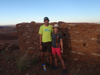
At Crack-In-The-Rock in Wupatki National Monument
     Early last spring we began tentatively planning for this summer.  We both had jobs to consider.  Sara at Grand Canyon Youth, and me at Run Flagstaff.  We both are also involved with the Flagstaff High School track and cross country teams, which would be difficult to leave mid-season.  Fortunately my boss at Run Flagstaff is letting me go without saying I am fired and Sara's commitment at GCY ended in December so we only have to ditch a few weeks of track.


In early summer we ordered maps and guidebooks.  I immediately fell in love with the Colorado through Montana sections of trail.  I love being above treeline and since we will hopefully not stray more than 50 miles from the Divide there should be a lot of time spent at that elevation.  Sara, on the other hand, is inexplicably excited about New Mexico.  Something about heat and scarce water makes her yearn for adventure.  Admittedly, New Mexico has it charms, like the Gila River Wilderness, but dehydration is not one of them to which I am looking forward.  This is definitely a trail for all interests in nature.
Forrest, Sara, and Zeno (who will join us on our hike) in West Fork of Oak Creek

All through 2012 we tried to make time for shorter backpack trips to test out equipment and gear we may take with us.  Just before Thanksgiving we managed to fit in a 4-day trip in the Grand Canyon that allowed us to become comfortable with what shoes, sleeping pads, and clothing we would like to take.  At this point our biggest piece of equipment in question is our stove.  We are looking for a liquid gas stove so we do not have to take canisters that do not allow us to know exactly how many more meals we can cook.  We are managing to go close to ultra-light, but have splurged on a camera.  Since Sara is an art major and has the ability to make things look pretty, we got her a DSLR for Christmas.  This will add extra weight, but the quality of pictures should make up for it.
Sara at Palisades Campground in the bottom of the Grand Canyon


At this point we have gone through all the maps, provided by Jonathan Ley, and plotted resupply points every 4-8 days.  Our next step is to go back through the maps and make sure we did not make too many math mistakes (which I have a tendency to do) and decide at which points we will mail ourselves boxes and at which points we will buy from a local store.
Rafts on the Colorado before Cardenas beach in the Grand Canyon

For now though we are just excited to have the opportunity to take such an adventure.  In the next week or so we will post our tentative schedule and gear-list.  We hope to begin posting about once a week with updates and pictures from previous trips from now until Canada in late September.  If you have any questions, comments or would like to help out please share.  If you would like another take on the trip please read the article by Abbie Gripman that appeared in the Arizona Daily Sun this morning.....here

Forrest and Sara